Cris Sakamoto
Geospatial Analysis
Data Strategy
Social Research
Maps
Index
Dissertation Maps
Industry Maps
Arts Maps
Demographic Maps
Chicago Historical Maps
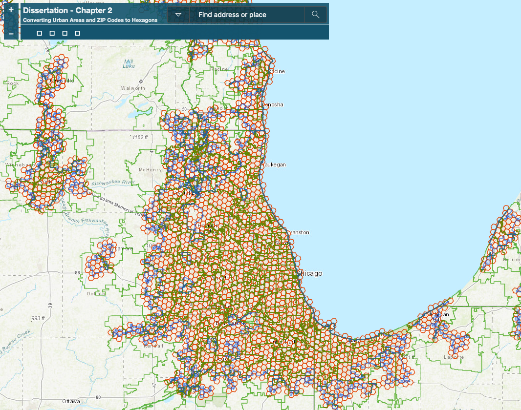
Dissertation Maps
Converting Urban Areas and ZIP codes to Hexagons
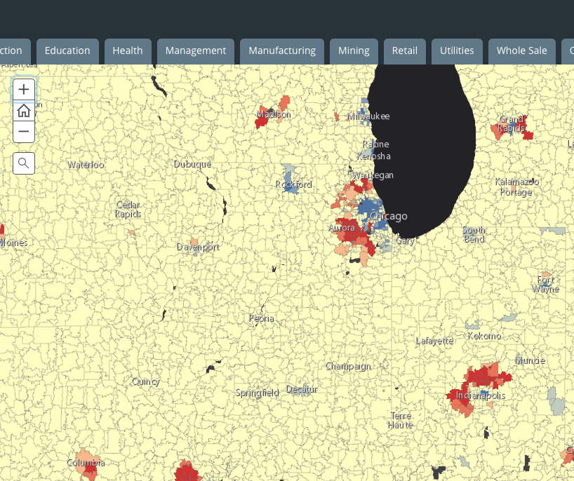
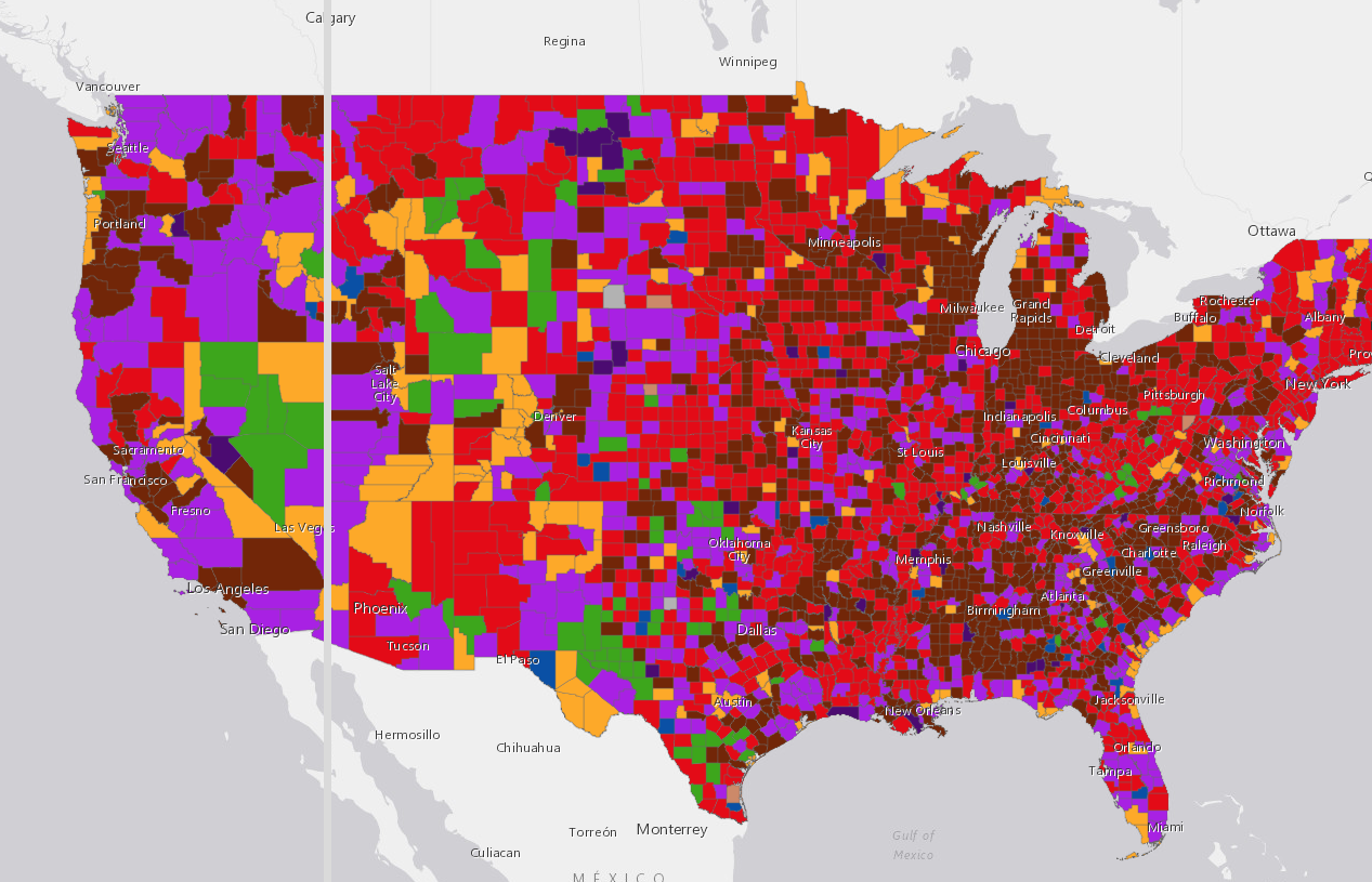
Industry Maps
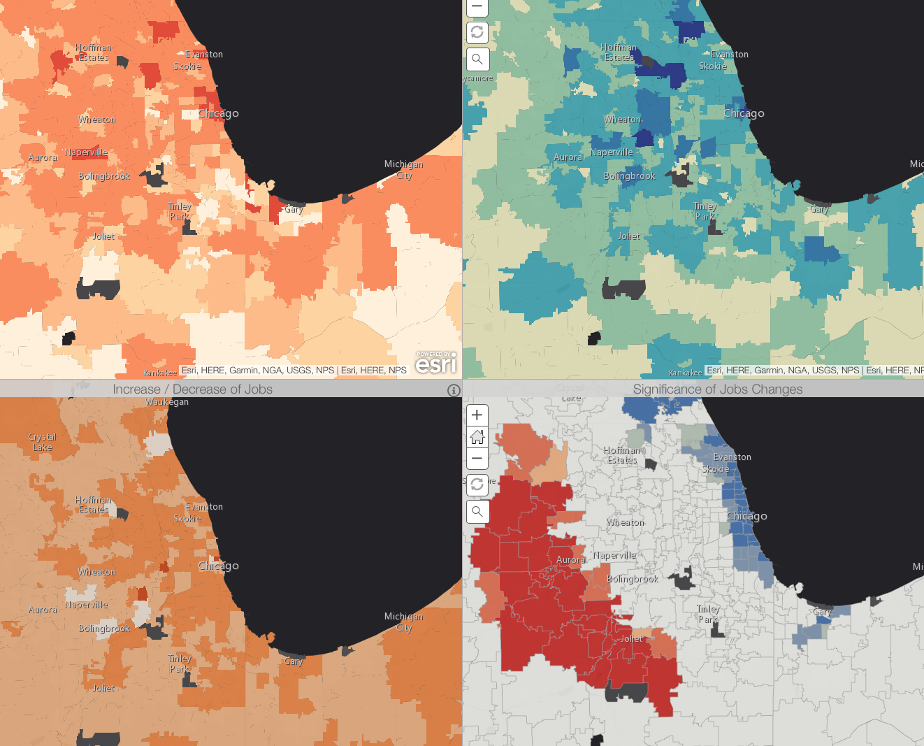
Industry Growth Between 1998 and 2015
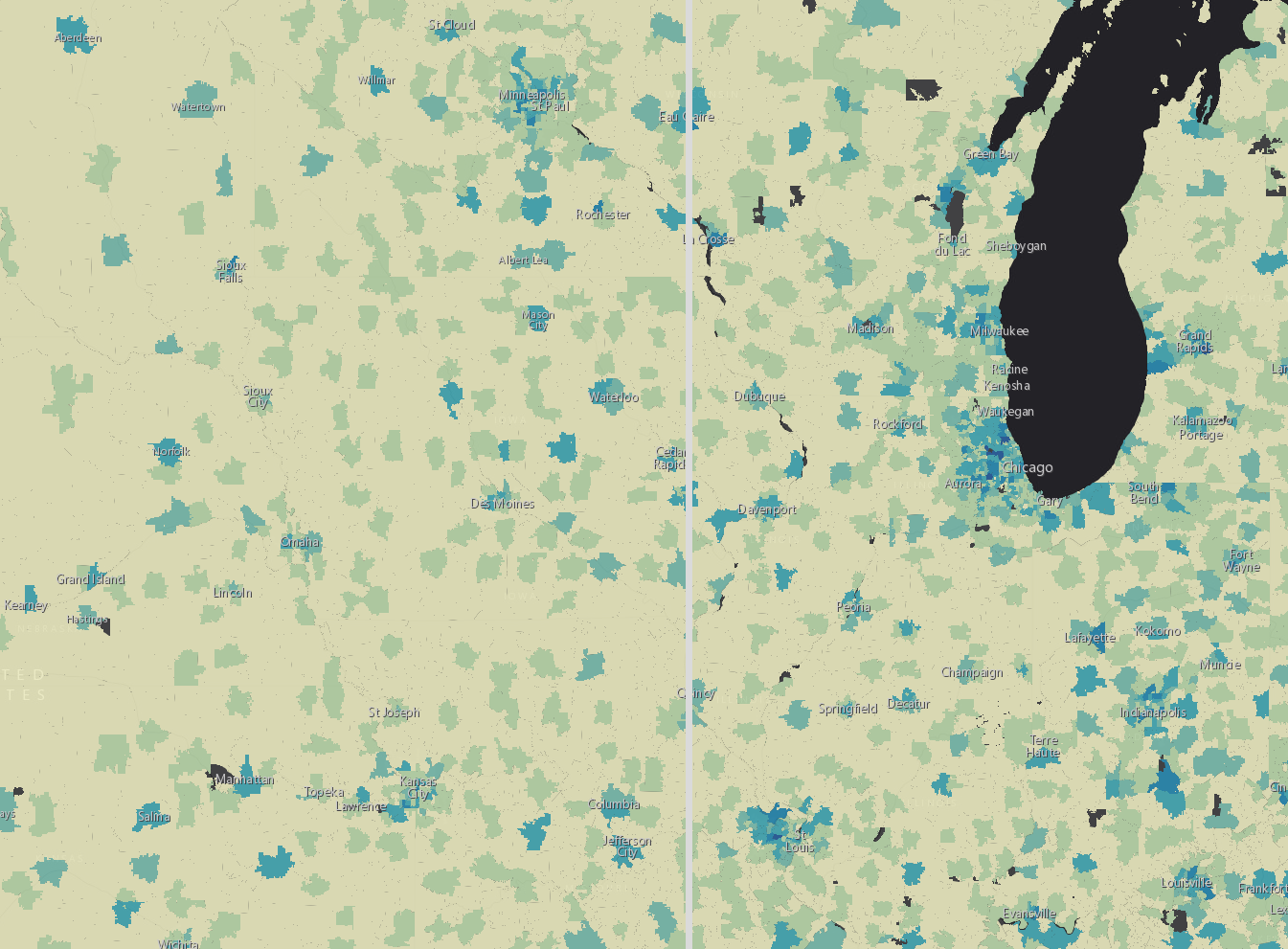
Predominant Industries by County
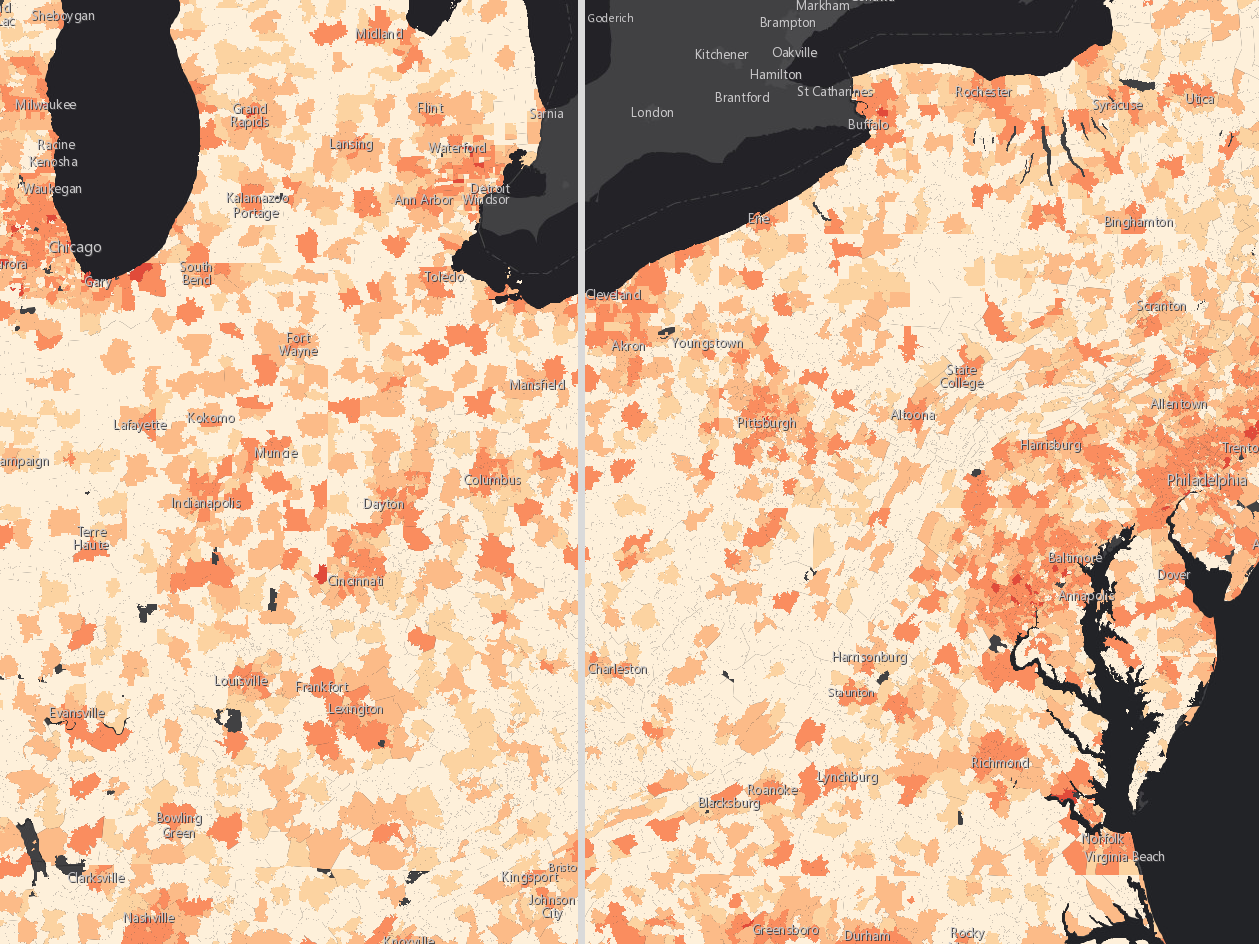
Comparison of Changes in Industry Structure
Where Are The High-Tech Jobs?
Arts Maps
Where Are The Artists?
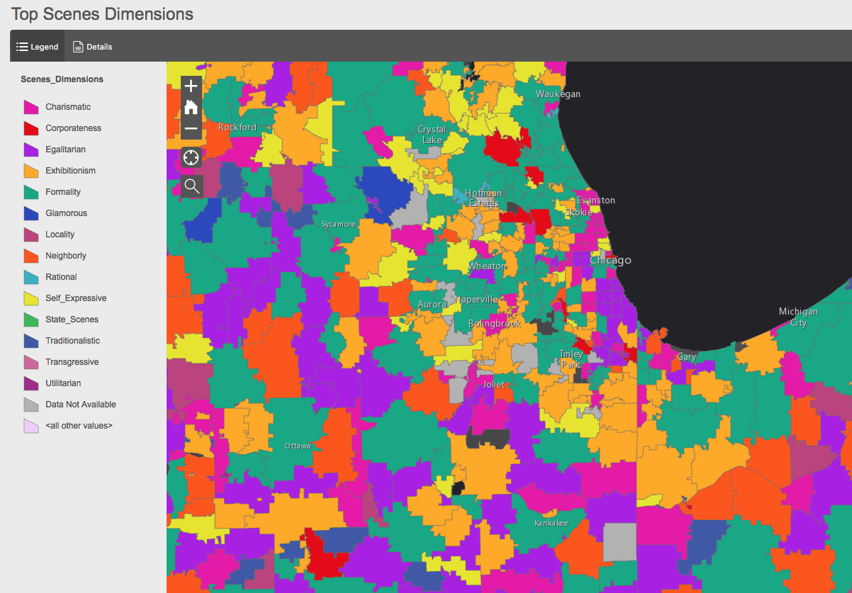
Most Dominant Scenes Dimensions by ZIP Code
Demographic Maps
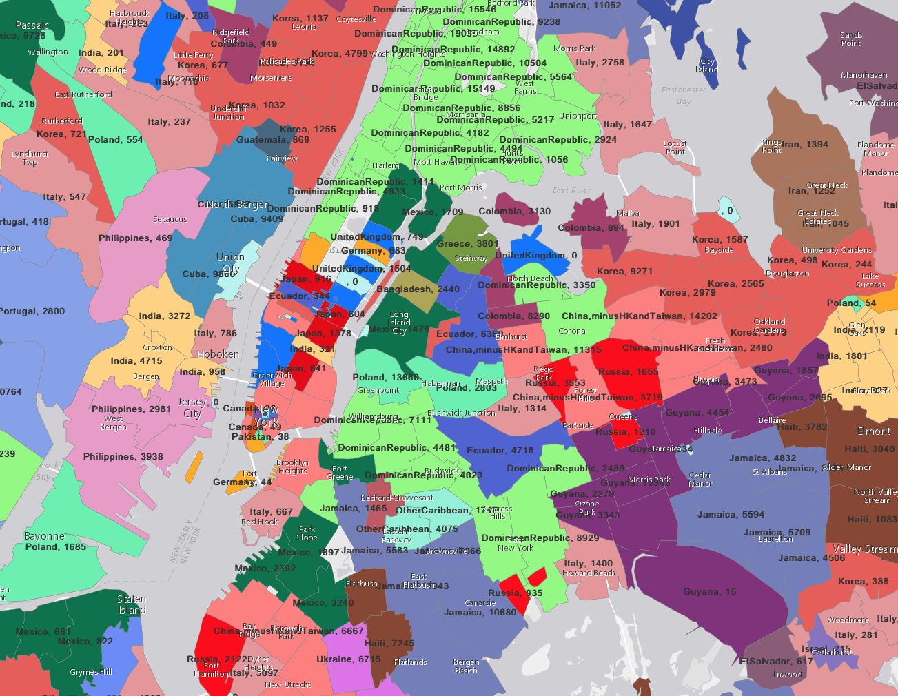
Most Predominant Country of Origins of Foreign Born Population by ZIP Code
Chicago Historical Maps
Regenstein Library Map Collection
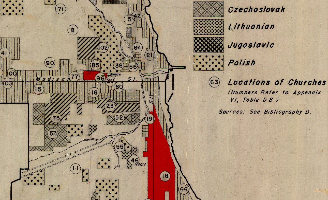
Community Settlements in Historic Chicago - 1840-1950

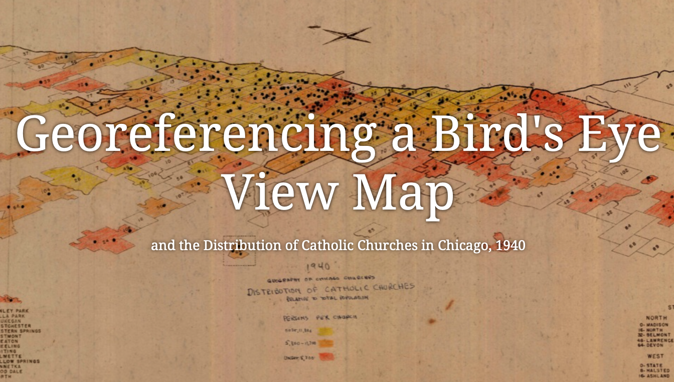
Georeferencing a Bird’s Eye View Map
Location of Presbyterian Churches in Chicago Relative to Ethnic Groups
Chicago Demographic Maps in the Early 20th Century
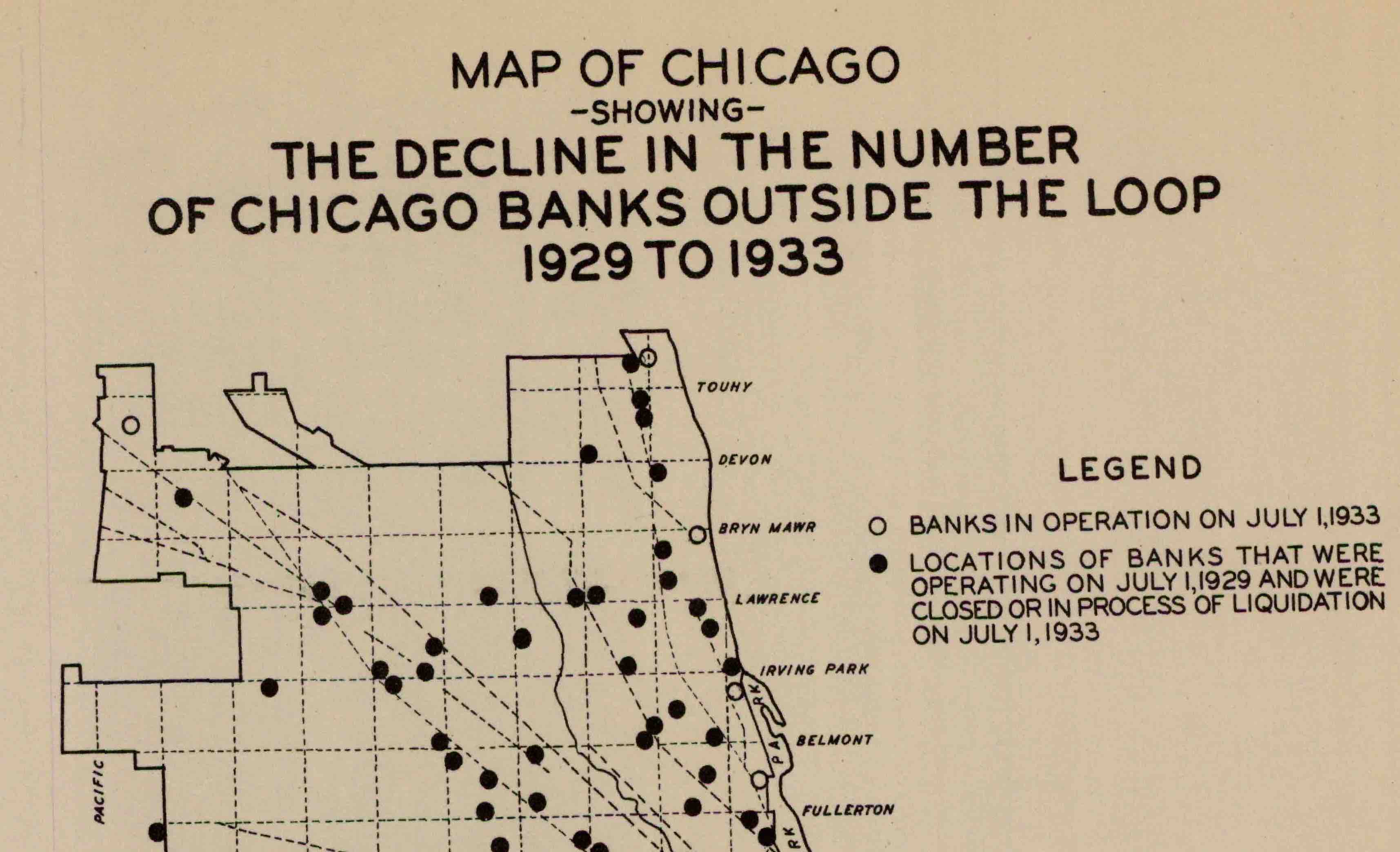
Decline of Banks in Chicago After the Crash of 1929
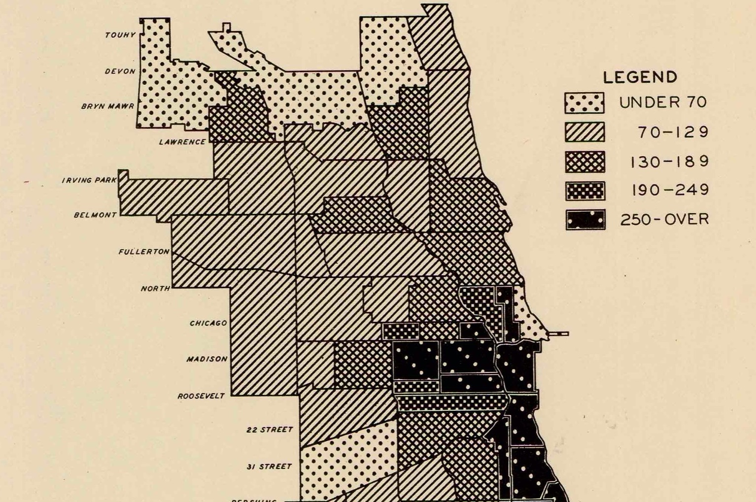
Rate of Psychopathologies in Chicago, 1922-1931